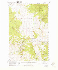
1958 Map of Avon
USGS Topo · Published 1979About this map
The Continental Divide serpentines across the northeastern corner of this 1958 survey, marking the high country of the Helena National Forest. The landscape is a complex of mining and ranching history, with the Northern Pacific railroad corridor following the Little Blackfoot River through the settlement of Avon. A notable inclusion is Blackfoot City (Ghost Town), once a bustling gold camp, situated along Ophir Creek near numerous Placer Mines and the Victory Mine.
Find a feature on this map
58 named features on this map. Tap any name to fly to it.
Don’t see what you’re looking for? This feature index may not catch every label — zoom into the map to look around manually.
Map Details
Editions of this 1958 Avon Map
4 editions found
Other maps of this area

1889 · Helena
USGS Topo · 1:250,000

1893 · Helena
USGS Topo · 1:250,000

1899 · Boulder
USGS Topo · 1:125,000

1899 · Helena
USGS Topo · 1:250,000

1903 · Helena
USGS Topo · 1:250,000

1947 · Butte
USGS Topo · 1:250,000

1954 · Basin
USGS Topo · 1:62,500

1958 · Butte
USGS Topo · 1:250,000

1958 · Avon
USGS Topo · 1:62,500

1958 · Garrison
USGS Topo · 1:62,500