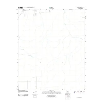
2011 Map of Avondale SE
USGS Topo · Published 2011About this map
Phoenix International Raceway stands as a prominent landmark in this desert landscape just south of the developing outskirts of Avondale. The terrain is defined by the winding course of the Gila River and the ephemeral Corgett Wash, which drain the arid basin. This 2011 survey captures the area as the grid of the Salt River Valley extends into the southwest, with established routes like Old Baseline Rd and W Dobbins Rd providing the framework for future growth. The contrast between the rigid road geometry and the natural, wandering paths of the waterways highlights the intersection of urban planning and desert geography during this era of Arizona's expansion.
Find a feature on this map
12 named features on this map. Tap any name to fly to it.
Don’t see what you’re looking for? This feature index may not catch every label — zoom into the map to look around manually.
Map Details
Editions of this 2011 Avondale SE Map
This is the sole edition of this map. No revisions or reprints were ever made.
Other maps of this area

1912 · Phoenix
USGS Topo · 1:62,500

1913 · Maricopa
USGS Topo · 1:62,500

1914 · Phoenix
USGS Topo · 1:62,500

1915 · Maricopa
USGS Topo · 1:62,500

1946 · Avondale
USGS Topo · 1:62,500

1948 · Cashion
USGS Topo · 1:62,500

1951 · Mobile
USGS Topo · 1:62,500

1952 · Laveen
USGS Topo · 1:24,000

1952 · Montezuma Peak
USGS Topo · 1:24,000

1952 · Fowler
USGS Topo · 1:24,000