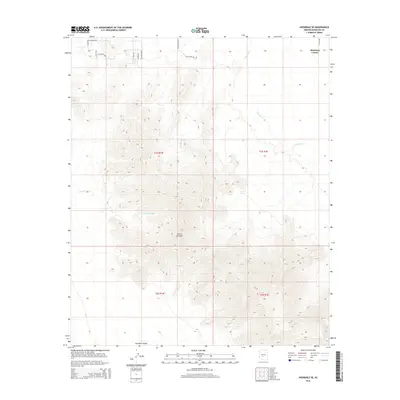
2014 Map of Avondale SE
USGS Topo · Published 2014About this map
The Sierra Estrella mountain range dominates this 2014 landscape, marking a sharp topographic transition southwest of the expanding Phoenix metropolitan area. Along the northern edge, the Gila River winds through the desert floor, passing the settlement of Maricopa Colony. This region illustrates the intersection of traditional land use and modern suburban encroachment, with precisely surveyed section lines of t1s r1w and t1s r1e meeting at the foothills. The presence of Corgett Wash and several named desert roads, such as Avenida Estrella and Dust Devil Rd, highlights the drainage patterns and transportation network serving the outlying communities of Rainbow Valley. The map detail captures a specific moment of rural character before further development altered the desert fringes of Maricopa County.
Find a feature on this map
19 named features on this map. Tap any name to fly to it.
Don’t see what you’re looking for? This feature index may not catch every label — zoom into the map to look around manually.
Map Details
Editions of this 2014 Avondale SE Map
This is the sole edition of this map. No revisions or reprints were ever made.
Other maps of this area

1912 · Phoenix
USGS Topo · 1:62,500

1913 · Maricopa
USGS Topo · 1:62,500

1914 · Phoenix
USGS Topo · 1:62,500

1915 · Maricopa
USGS Topo · 1:62,500

1946 · Avondale
USGS Topo · 1:62,500

1948 · Cashion
USGS Topo · 1:62,500

1951 · Mobile
USGS Topo · 1:62,500

1952 · Laveen
USGS Topo · 1:24,000

1952 · Montezuma Peak
USGS Topo · 1:24,000

1952 · Fowler
USGS Topo · 1:24,000