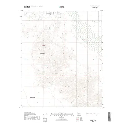
2018 Map of Avondale SE
USGS Topo · Published 2018About this map
The Sierra Estrella mountain range dominates the southern half of this landscape, its steep contours rising sharply above the desert floor south of Avondale and Goodyear. The northeastern corner of the map reveals the braided course of the Gila River, which flows through an area of flat, low-lying terrain. The transition from the rugged peaks of the Sierra Estrella to the valley below is marked by drainage patterns like Corgett Wash. In the northern portion of the quadrangle, a network of roads such as W Stagecoach Rd, W Road Course Rd, and W Dragstrip Rd hints at the area's specific recreational and residential development. Tracing the Long Loop provides a detailed view of the complex topography that separates the developing suburban edge from the wilderness of the mountain range.
Find a feature on this map
29 named features on this map. Tap any name to fly to it.
Don’t see what you’re looking for? This feature index may not catch every label — zoom into the map to look around manually.
Map Details
Editions of this 2018 Avondale SE Map
This is the sole edition of this map. No revisions or reprints were ever made.
Other maps of this area

1912 · Phoenix
USGS Topo · 1:62,500

1913 · Maricopa
USGS Topo · 1:62,500

1914 · Phoenix
USGS Topo · 1:62,500

1915 · Maricopa
USGS Topo · 1:62,500

1946 · Avondale
USGS Topo · 1:62,500

1948 · Cashion
USGS Topo · 1:62,500

1951 · Mobile
USGS Topo · 1:62,500

1952 · Laveen
USGS Topo · 1:24,000

1952 · Montezuma Peak
USGS Topo · 1:24,000

1952 · Fowler
USGS Topo · 1:24,000