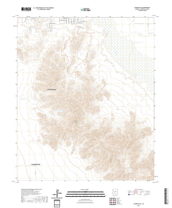
2021 Map of Avondale SE
USGS Topo · Published 2021About this map
Sierra Estrella dominates this 2021 landscape, rising sharply above the desert floor southwest of the expanding residential peripheries of Avondale and Goodyear. The northeastern portion of the sheet is defined by the braided path of the Gila River, where seasonal wetlands contrast with the arid slopes of the surrounding range. The drainage of Corgett Wash cuts through the foothills, illustrating the complex hydrology of the Sonoran desert. While the map shows some suburban street development like S 139th Ave and W Beverly Rd on the valley floor, the interior mountains remain relatively undeveloped, accessible primarily by routes such as Long Loop Trl. Notable recreational or specialized infrastructure is evident near the northern margin, including W Dragstrip Rd and W Road Course Rd, reflecting the area's modern land-use transitions.
Find a feature on this map
28 named features on this map. Tap any name to fly to it.
Don’t see what you’re looking for? This feature index may not catch every label — zoom into the map to look around manually.
Map Details
Editions of this 2021 Avondale SE Map
This is the sole edition of this map. No revisions or reprints were ever made.
Other maps of this area

1912 · Phoenix
USGS Topo · 1:62,500

1913 · Maricopa
USGS Topo · 1:62,500

1914 · Phoenix
USGS Topo · 1:62,500

1915 · Maricopa
USGS Topo · 1:62,500

1946 · Avondale
USGS Topo · 1:62,500

1948 · Cashion
USGS Topo · 1:62,500

1951 · Mobile
USGS Topo · 1:62,500

1952 · Laveen
USGS Topo · 1:24,000

1952 · Montezuma Peak
USGS Topo · 1:24,000

1952 · Fowler
USGS Topo · 1:24,000