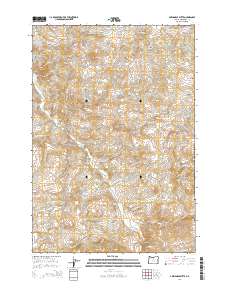
2014 Map of Axehandle Butte
USGS Topo · Published 2014About this map
Ashwood serves as the primary settlement within this high-desert landscape in Jefferson County, situated along the banks of Trout Cr. The terrain is defined by a series of volcanic features and drainage networks, with Axehandle Butte and Axehandle Ridge dominating the northeastern sector. A sophisticated system of creeks, including Clover Cr and Gooseberry Cr, carves through the landscape, feeding into larger watercourses. To the west, the topography rises sharply at Grater Butte and Ash Butte, while the central portion is marked by the prominence of Thompson Peak. This 2014 survey documents the enduring ranching and rural character of the region, where roads like NE Gonser Rd provide access to family-named landmarks and secluded points such as Axehandle Spring.
Find a feature on this map
29 named features on this map. Tap any name to fly to it.
Don’t see what you’re looking for? This feature index may not catch every label — zoom into the map to look around manually.
Map Details
Editions of this 2014 Axehandle Butte Map
This is the sole edition of this map. No revisions or reprints were ever made.
Other maps of this area

1955 · Bend
USGS Topo · 1:250,000

1957 · Bend
USGS Topo · 1:250,000

1958 · Bend
USGS Topo · 1:250,000

1966 · Antelope
USGS Topo · 1:62,500

1966 · Willowdale
USGS Topo · 1:62,500

1968 · Horse Heaven Creek
USGS Topo · 1:24,000

1968 · Axehandle Butte
USGS Topo · 1:24,000

1968 · Dutchman Creek
USGS Topo · 1:24,000

1968 · Ashwood
USGS Topo · 1:24,000

1968 · Opal Mountain
USGS Topo · 1:24,000