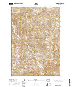
2020 Map of Axehandle Butte
USGS Topo · Published 2020About this map
Ashwood serves as the primary point of settlement in this high-desert landscape of Jefferson County, where the terrain is defined by a series of prominent volcanic features and seasonal watercourses. The topography rises sharply from Fools Hollow and Long Hollow toward landmarks like Iron Mtn, Axehandle Butte, and Thompson Peak. This modern survey illustrates the enduring grazing and ranching patterns of the region, anchored by the reliable Axehandle Spring and the drainage network of Trout Cr, which is fed by numerous tributaries including Cultus Cr and Big Whetstone Cr. The map reveals a remote network of unpaved access routes like NE Gosner Rd and NE Trout Creek Rd that connect isolated peaks such as Gooseberry Mtn and Tompkins Butte across the undulating central Oregon plateau.
Find a feature on this map
34 named features on this map. Tap any name to fly to it.
Don’t see what you’re looking for? This feature index may not catch every label — zoom into the map to look around manually.
Map Details
Editions of this 2020 Axehandle Butte Map
This is the sole edition of this map. No revisions or reprints were ever made.
Other maps of this area

1955 · Bend
USGS Topo · 1:250,000

1957 · Bend
USGS Topo · 1:250,000

1958 · Bend
USGS Topo · 1:250,000

1966 · Antelope
USGS Topo · 1:62,500

1966 · Willowdale
USGS Topo · 1:62,500

1968 · Horse Heaven Creek
USGS Topo · 1:24,000

1968 · Axehandle Butte
USGS Topo · 1:24,000

1968 · Dutchman Creek
USGS Topo · 1:24,000

1968 · Ashwood
USGS Topo · 1:24,000

1968 · Opal Mountain
USGS Topo · 1:24,000