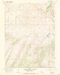
1966 Map of Axial
USGS Topo · Published 1970About this map
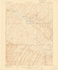
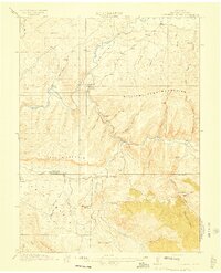
The Axial Basin forms a striking geographic center for this mid-1960s survey of Moffat County, where a ranching and mining economy defined the high-elevation landscape. The settlement of Axial and nearby family operations like Wilson Ranch, Circle Bar Ranch, and Gossard Ranch demonstrate the distributed nature of rural life along the drainage of Milk Creek. To the north and south, the terrain rises sharply toward Duffy Mountain and Mount Streeter, creating a natural corridor for transport and water management.
Find a feature on this map
28 named features on this map. Tap any name to fly to it.
Don’t see what you’re looking for? This feature index may not catch every label — zoom into the map to look around manually.
Map Details
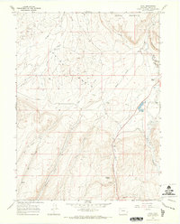
Editions of this 1966 Axial Map
2 editions found
Other maps of this area

1910 · Danforth Hills
USGS Topo · 1:125,000
1912 · Meeker
USGS Topo · 1:62,500

1912 · Axial
USGS Topo · 1:62,500
1914 · Meeker
USGS Topo · 1:62,500
1914 · Axial
USGS Topo · 1:62,500
1915 · Monument Butte
USGS Topo · 1:62,500

1954 · Craig
USGS Topo · 1:250,000

1957 · Craig
USGS Topo · 1:250,000

1958 · Craig
USGS Topo · 1:250,000

1960 · Craig
USGS Topo · 1:250,000