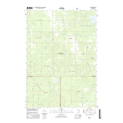
2017 Map of Axin
USGS Topo · Published 2017About this map
Axin sits at the intersection of a vast woodland and wetland network within the Manistee National Forest, where the boundaries of Wexford, Lake, and Osceola counties converge. This 2017 survey details a landscape defined by its water and family history, with Spalding Cr, Mitchell Cr, and Fairchild Cr threading through the dense forest cover. For those tracing local roots, the map identifies several small burial grounds including the Larson Family Cem and Irwin Family Center Cem near the eastern edge of the quadrangle.
Find a feature on this map
32 named features on this map. Tap any name to fly to it.
Don’t see what you’re looking for? This feature index may not catch every label — zoom into the map to look around manually.
Map Details
Editions of this 2017 Axin Map
This is the sole edition of this map. No revisions or reprints were ever made.
Other maps of this area

1933 · Luther SE
USGS Topo · 1:31,680

1933 · Luther SW
USGS Topo · 1:31,680

1933 · Luther NW
USGS Topo · 1:31,680

1954 · Traverse City
USGS Topo · 1:250,000

1956 · Mesick
USGS Topo · 1:62,500

1956 · Cadillac North
USGS Topo · 1:62,500

1957 · Cadillac South
USGS Topo · 1:62,500

1957 · Luther
USGS Topo · 1:62,500

1958 · Traverse City
USGS Topo · 1:250,000

1983 · Cadillac
USGS Topo · 1:100,000