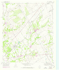
1956 Map of Axtell
USGS Topo · Published 1978About this map
The intersection of the St Louis Southwestern and the Industrial Railroad defines the transportation hub at Axtell during the mid-20th century. This region of McLennan County is a patchwork of rural homesteads and agricultural land, where a complex network of waterways like Tehuacana Creek, Williams Creek, and Salt Creek flow toward the tri-county border area. The map illustrates the social centers of the era, including Olive Branch Ch and Billington Ch, alongside community landmarks such as Cottonbelt Lake.
Find a feature on this map
30 named features on this map. Tap any name to fly to it.
Don’t see what you’re looking for? This feature index may not catch every label — zoom into the map to look around manually.
Map Details
Editions of this 1956 Axtell Map
2 editions found
Other maps of this area

1892 · Waco
USGS Topo · 1:125,000

1920 · Waco
USGS Topo · 1:125,000

1920 · Mart
USGS Topo · 1:62,500

1931 · Elm Mott
USGS Topo · 1:62,500

1954 · Waco
USGS Topo · 1:250,000

1955 · Waco
USGS Topo · 1:250,000

1956 · Hubbard
USGS Topo · 1:24,000

1956 · Penelope
USGS Topo · 1:24,000

1956 · Axtell
USGS Topo · 1:24,000

1956 · West
USGS Topo · 1:24,000