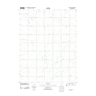
2012 Map of Axtell NW
USGS Topo · Published 2012About this map
Mission Creek Cem and Guittard Cem anchor this rural landscape in Marshall County, marking the burial sites of early generations in the northeastern Kansas prairie. The area is defined by a grid of agricultural section lines, including named thoroughfares like Alamo Rd, Cherokee Rd, and Frontier Rd. These roads navigate a terrain deeply etched by a network of drainage systems, with Robidoux Cr and Murdock Cr winding through the fields. The drainage pattern reflects the natural topography that influenced farmstead placement and rural development long before modern mapping. Smaller tributaries like Spring Cr and N Elm Cr further subdivide the land, illustrating how local water sources dictated the organization of this farming community.
Find a feature on this map
17 named features on this map. Tap any name to fly to it.
Don’t see what you’re looking for? This feature index may not catch every label — zoom into the map to look around manually.
Map Details
Editions of this 2012 Axtell NW Map
This is the sole edition of this map. No revisions or reprints were ever made.
Other maps of this area

1889 · Seneca
USGS Topo · 1:125,000

1889 · Marysville
USGS Topo · 1:125,000

1894 · Seneca
USGS Topo · 1:125,000

1894 · Marysville
USGS Topo · 1:125,000

1955 · Manhattan
USGS Topo · 1:250,000

1955 · Lincoln
USGS Topo · 1:250,000

1956 · Manhattan
USGS Topo · 1:250,000

1957 · Manhattan
USGS Topo · 1:250,000

1957 · Lincoln
USGS Topo · 1:250,000

1958 · Lincoln
USGS Topo · 1:250,000