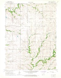
1966 Map of Axtell NW
USGS Topo · Published 1967About this map
The Marshall County and Pawnee County borderlands in Kansas meet the Nebraska state line in this mid-1960s topographic study. The landscape is defined by the dendritic drainage of several prominent waterways, most notably Mission Creek and Robidoux Creek. This area preserves several centers of community life, such as the Mission Creek Community Center and Richland Center Church. Genealogy researchers will find value in the placement of the Mission Creek Cemetery and Guittard Cemetery, providing exact locations for early burial sites. Transportation and infrastructure are represented by the Union Pacific Railroad cutting through the southeast corner and a mid-century Landing Strip in the Richland township. The map effectively captures the agricultural layout across the Balderson, Franklin, and Guittard townships at a time when small rural institutions still anchored the countryside.
Find a feature on this map
24 named features on this map. Tap any name to fly to it.
Don’t see what you’re looking for? This feature index may not catch every label — zoom into the map to look around manually.
Map Details
Editions of this 1966 Axtell NW Map
This is the sole edition of this map. No revisions or reprints were ever made.
Other maps of this area

1889 · Seneca
USGS Topo · 1:125,000

1889 · Marysville
USGS Topo · 1:125,000

1894 · Seneca
USGS Topo · 1:125,000

1894 · Marysville
USGS Topo · 1:125,000

1955 · Manhattan
USGS Topo · 1:250,000

1955 · Lincoln
USGS Topo · 1:250,000

1956 · Manhattan
USGS Topo · 1:250,000

1957 · Manhattan
USGS Topo · 1:250,000

1957 · Lincoln
USGS Topo · 1:250,000

1958 · Lincoln
USGS Topo · 1:250,000