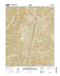
2016 Map of Axton
USGS Topo · Published 2016About this map
Axton serves as a central hub in this Virginia landscape, situated along a prominent transportation corridor where the borders of Henry Co and Pittsylvania Co meet. The area is defined by a dense network of watercourses, including the W Fork Sandy River and the S Prong Sandy River, which drain the undulating terrain near Glady Fork Mtn. Established settlements like Soapstone, Boxwood, and Leatherwood are connected by a web of rural routes such as Mountain Valley Rd and Co RD 613. Local infrastructure is further highlighted by the presence of Robinson Lake and Reservoir Number 5, reflecting the historical importance of water management for these Piedmont communities. The map provides a clear view of the residential and agricultural layout of the region, from the suburban outskirts of Chatmoss and Stockton to the more dispersed homesteads near Sandy River.
Find a feature on this map
93 named features on this map. Tap any name to fly to it.
Don’t see what you’re looking for? This feature index may not catch every label — zoom into the map to look around manually.
Map Details
Editions of this 2016 Axton Map
This is the sole edition of this map. No revisions or reprints were ever made.
Other maps of this area

1922 · Callands
USGS Topo · 1:48,000

1924 · Martinsville
USGS Topo · 1:48,000

1924 · Draper
USGS Topo · 1:48,000

1924 · Callands
USGS Topo · 1:62,500

1925 · Rocky Mount
USGS Topo · 1:48,000

1926 · Martinsville
USGS Topo · 1:62,500

1926 · Draper
USGS Topo · 1:62,500

1927 · Rocky Mount
USGS Topo · 1:62,500

1927 · Martinsville
USGS Topo · 1:62,500

1944 · Martinsville
USGS Topo · 1:62,500