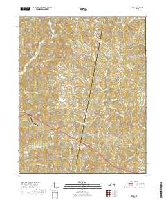
2019 Map of Axton
USGS Topo · Published 2019About this map
Axton and Leatherwood serve as the primary hubs in this southern Virginia landscape, situated along the border of Henry and Pittsylvania counties. The area is defined by a dense network of tributaries feeding into the Sandy River and S Prong Sandy River, creating a complex series of ridges and valleys that include landmarks like Glady Fork Mtn. Development is concentrated along corridors like Old Danville Rd, connecting small settlements such as Stockton and Boxwood with the more industrial character of Soapstone to the east. Water resources appear vital to the local geography, evidenced by features such as Robinson Lake and Reservoir Number 5. The map provides a contemporary view of these rural communities, where modern names like Winter Haven and Medical Center Rd exist alongside traditional family-named watercourses such as Suckegg Br and Petras Br.
Find a feature on this map
93 named features on this map. Tap any name to fly to it.
Don’t see what you’re looking for? This feature index may not catch every label — zoom into the map to look around manually.
Map Details
Editions of this 2019 Axton Map
This is the sole edition of this map. No revisions or reprints were ever made.
Other maps of this area

1922 · Callands
USGS Topo · 1:48,000

1924 · Martinsville
USGS Topo · 1:48,000

1924 · Draper
USGS Topo · 1:48,000

1924 · Callands
USGS Topo · 1:62,500

1925 · Rocky Mount
USGS Topo · 1:48,000

1926 · Martinsville
USGS Topo · 1:62,500

1926 · Draper
USGS Topo · 1:62,500

1927 · Rocky Mount
USGS Topo · 1:62,500

1927 · Martinsville
USGS Topo · 1:62,500

1944 · Martinsville
USGS Topo · 1:62,500