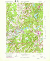
1966 Map of Ayer
USGS Topo · Published 1979About this map
Fort Devens Military Reservation dominates the western landscape of this mid-century survey, its expansive reach covering the Fort Devens Airport and numerous tactical training grounds. The industrial and residential center of Ayer serves as a critical junction for the Boston and Maine Railroad, where rail lines converge near Grove Pond and Flannagan Pond. This connectivity underscores the area's role as a major regional transport hub between the military installation and the surrounding agricultural and educational lands.
Find a feature on this map
63 named features on this map. Tap any name to fly to it.
Don’t see what you’re looking for? This feature index may not catch every label — zoom into the map to look around manually.
Map Details
Editions of this 1966 Ayer Map
3 editions found
Other maps of this area

1886 · Lowell
USGS Topo · 1:62,500

1886 · Framingham
USGS Topo · 1:62,500

1887 · Marlboro
USGS Topo · 1:62,500

1889 · Marlboro
USGS Topo · 1:62,500

1889 · Framingham
USGS Topo · 1:62,500

1893 · Lowell
USGS Topo · 1:62,500

1893 · Groton
USGS Topo · 1:62,500

1894 · Framingham
USGS Topo · 1:62,500

1896 · Marlboro
USGS Topo · 1:62,500

1898 · Marlboro
USGS Topo · 1:62,500