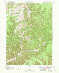
1947 Map of Ayers Hill
USGS Topo · Published 1970About this map
The mountain settlements of Ayers Hill and Borie anchor this mid-century survey of the Potter County highlands. The landscape is defined by its deep hollows and narrow runs, where early transportation routes like the Jersey Shore Turnpike and Patterson Road follow the natural contours of the land. Evidence of the region's logging and hunting heritage is visible in labels for the Splash Dam on the West Branch and several shanty sites, while the presence of the United Brethren Ch and family-named cemeteries such as Anson Cem and Jackson Cem provide essential data points for genealogical research. The northern reaches show the early development of the Coudersport Country Club, contrasting with the more primitive networks of the Ayers Shanty Trail and Gillon Trail that crisscross the steep ridges of Sylvania and Summit townships.
Find a feature on this map
76 named features on this map. Tap any name to fly to it.
Don’t see what you’re looking for? This feature index may not catch every label — zoom into the map to look around manually.
Map Details
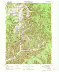
Editions of this 1947 Ayers Hill Map
Other maps of this area

1932 · Genesee
USGS Topo · 1:62,500

1934 · Coudersport
USGS Topo · 1:48,000

1937 · Genesee
USGS Topo · 1:62,500

1938 · Coudersport
USGS Topo · 1:62,500

1947 · Conrad
USGS Topo · 1:62,500

1947 · Conrad
USGS Topo · 1:24,000

1947 · Short Run
USGS Topo · 1:24,000

1947 · Ayers Hill
USGS Topo · 1:24,000

1947 · Cherry Springs
USGS Topo · 1:24,000

1948 · Emporium
USGS Topo · 1:62,500
Featured Places
- Sweden Township, PA
- Borie, Summit Township
- Summit Township, PA
- Sylvania Township, PA
- Eulalia Township, PA