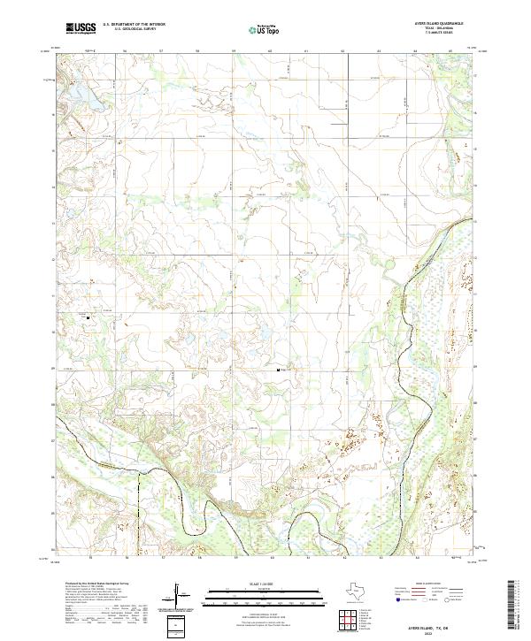
2022 Map of Ayers Island
USGS Topo · Published 2022About this map
The confluence of the Red River and its Salt Fork Red River tributary defines this borderland landscape along the boundary between Texas and Oklahoma. The terrain is characterized by the winding path of Gypsum Cr, which drains toward the river system through a network of rural section roads. Evidence of long-standing community ties to the land is found at Carmel Cem in the west and Boggy Cem near the center of the quadrangle. These small burial grounds, along with the presence of Mitchell Lake, mark the quiet agricultural character of Wilbarger County. The grid-like road system, including e1780 RD and n1970 RD, reflects the persistent land-use patterns of the Southern Plains, where life revolves around the watercourses and the state line.
Find a feature on this map
26 named features on this map. Tap any name to fly to it.
Don’t see what you’re looking for? This feature index may not catch every label — zoom into the map to look around manually.
Map Details
Editions of this 2022 Ayers Island Map
This is the sole edition of this map. No revisions or reprints were ever made.
Other maps of this area

1955 · Lawton
USGS Topo · 1:250,000

1958 · Elmer
USGS Topo · 1:62,500

1960 · Quanah
USGS Topo · 1:62,500

1963 · Altus SE
USGS Topo · 1:24,000

1964 · Olustee
USGS Topo · 1:24,000

1971 · Prairie Hill
USGS Topo · 1:24,000

1975 · Elmore City NE
USGS Topo · 1:24,000

1975 · Quanah NE
USGS Topo · 1:24,000
1984 · Elmer
USGS Topo · 1:24,000
1984 · Quanah NE
USGS Topo · 1:24,000