
1975 Map of Quanah NE
USGS Topo · Published 1975About this map
The Red River winds through the southern portion of this orthophotomap, defining the physical and political boundary between Oklahoma and Texas during the mid-1970s. This aerial perspective captures the river's wide, braided channel and the confluence where Sandy Creek feeds into it from the north. The surrounding landscape in Jackson County is characterized by a geometric grid of agricultural fields and grazing land, revealing the intensive land-use patterns of the Southern Plains. While the imagery shows various rural structures and access roads, the primary focus remains on the natural hydrology of the basin and the complex textures of the riparian zone. This specific format, an orthophotograph, provides a direct visual record of the vegetation and soil conditions as they existed in early February when the original aerial photography was conducted.
Find a feature on this map
2 named features on this map. Tap any name to fly to it.
Don’t see what you’re looking for? This feature index may not catch every label — zoom into the map to look around manually.
Map Details
Editions of this 1975 Quanah NE Map
This is the sole edition of this map. No revisions or reprints were ever made.
Other maps of this area

1955 · Lawton
USGS Topo · 1:250,000

1958 · Elmer
USGS Topo · 1:62,500

1960 · Quanah
USGS Topo · 1:62,500

1964 · Olustee
USGS Topo · 1:24,000

1971 · Duke SW
USGS Topo · 1:24,000

1971 · Prairie Hill
USGS Topo · 1:24,000

1975 · Quanah NW
USGS Topo · 1:24,000
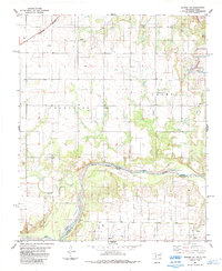
1984 · Quanah NE
USGS Topo · 1:24,000
1984 · Quanah East
USGS Topo · 1:24,000
1984 · Chillicothe
USGS Topo · 1:24,000