
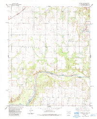
1975 Map of Quanah NW
USGS Topo · Published 1975About this map
The Red River creates a wide, meandering boundary across this landscape, captured in a 1975 orthophoto that emphasizes the agricultural grid of southwestern Oklahoma. This advance print provides a rare photographic look at the land patterns just south of Eldorado, where the cultivated fields of Jackson County meet the brushy, shifting margins of the river bottom. The path of Sandy Creek cuts diagonally across the central plains, its seasonal flow marked by distinctive vegetation that stands out against the surrounding farmland. Researchers can observe the mid-century layout of rural roads and section lines that define the region's cattle and cotton country. Because this document uses aerial imagery rather than traditional topographic lines, it preserves a literal view of the ground cover and farmsteads as they existed during the mid-1970s.
Find a feature on this map
3 named features on this map. Tap any name to fly to it.
Don’t see what you’re looking for? This feature index may not catch every label — zoom into the map to look around manually.
Map Details
Editions of this 1975 Quanah NW Map
This is the sole edition of this map. No revisions or reprints were ever made.
Other maps of this area

1955 · Lawton
USGS Topo · 1:250,000

1960 · Goodlett
USGS Topo · 1:62,500

1960 · Quanah
USGS Topo · 1:62,500

1961 · Hollis
USGS Topo · 1:62,500

1971 · Duke SW
USGS Topo · 1:24,000

1971 · Prairie Hill
USGS Topo · 1:24,000

1975 · Hollis SE
USGS Topo · 1:24,000

1975 · Quanah NE
USGS Topo · 1:24,000
1984 · Quanah NE
USGS Topo · 1:24,000
1984 · Quanah West
USGS Topo · 1:24,000