
1975 Map of Hollis SE
USGS Topo · Published 1975About this map
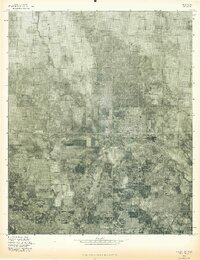
The wide, braided channel of the Red River dominates the southwestern corner of this orthophotomap, marking the boundary where Oklahoma meets Texas in Harmon County. This mid-1970s aerial survey reveals a landscape largely defined by a grid of agricultural fields and pastureland. The meandering course of Sandy Louis Creek winds southward through the center of the sheet, its riparian vegetation appearing as darker, organic shapes against the lighter geometric patterns of the cultivated plains. The orthophoto format provides a clear visual record of the land use patterns and water management during this era, showing the relationship between the major river system and the smaller drainage of the creek as they intersect the rural landscape.
Find a feature on this map
2 named features on this map. Tap any name to fly to it.
Don’t see what you’re looking for? This feature index may not catch every label — zoom into the map to look around manually.
Map Details
Editions of this 1975 Hollis SE Map
This is the sole edition of this map. No revisions or reprints were ever made.
Other maps of this area

1955 · Lawton
USGS Topo · 1:250,000

1960 · Goodlett
USGS Topo · 1:62,500

1960 · Quanah
USGS Topo · 1:62,500

1961 · Hollis
USGS Topo · 1:62,500

1971 · Mc Queen
USGS Topo · 1:24,000

1971 · Duke SW
USGS Topo · 1:24,000

1975 · Hollis NE
USGS Topo · 1:24,000

1975 · Quanah NW
USGS Topo · 1:24,000
1975 · Hollis NW
USGS Topo · 1:24,000
1984 · Willams
USGS Topo · 1:24,000