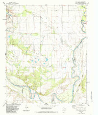
1985 Map of Ayers Island
USGS Topo · Published 1985About this map
The Red River and the Salt Fork Red River define this stretch of the Texas-Oklahoma border, winding through a landscape shaped by both natural drainage and industrial activity. Near the western edge, the Creta Mine and its associated tailings and ponds represent the area's mineral extraction history, while the Atchison Topeka and Santa Fe railroad tracks cut across the southeastern corner. Local genealogy is grounded in sites like Carmel Cem and Boggy Cem, which serve as quiet markers of the community alongside the agricultural infrastructure of scattered Storage Bins. The eponymous Ayers Island sits in a wide bend of the river, highlighting the shifting river boundaries between Jackson and Wilbarger counties.
Find a feature on this map
15 named features on this map. Tap any name to fly to it.
Don’t see what you’re looking for? This feature index may not catch every label — zoom into the map to look around manually.
Map Details
Editions of this 1985 Ayers Island Map
This is the sole edition of this map. No revisions or reprints were ever made.
Other maps of this area

1955 · Lawton
USGS Topo · 1:250,000

1958 · Elmer
USGS Topo · 1:62,500

1960 · Quanah
USGS Topo · 1:62,500

1963 · Altus SE
USGS Topo · 1:24,000

1964 · Olustee
USGS Topo · 1:24,000

1971 · Prairie Hill
USGS Topo · 1:24,000

1975 · Elmore City NE
USGS Topo · 1:24,000

1975 · Quanah NE
USGS Topo · 1:24,000
1984 · Elmer
USGS Topo · 1:24,000
1984 · Quanah NE
USGS Topo · 1:24,000