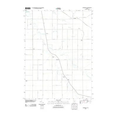
2010 Map of Ayersville
USGS Topo · Published 2010About this map
Powell Creek and its many tributaries, including North Powell Creek and Hogback Run, carve a dendritic pattern through this agricultural landscape on the border of Defiance and Putnam counties. The settlement pattern is defined by small rural hubs such as Ayersville and Arthur, connected by a rigorous grid of section-line roads like Ayersville Pleasant Bend Rd. For genealogists, the map is particularly detailed in its placement of family-named burial grounds, including the Taylor Cemetery, Ice Cemetery, and Mansfield Cemetery, which are often located near the creek bends. The transition from traditional farming to local aviation is visible in the placement of Blevins Airport and the Bauer Landing Strip, while the northwest corner preserves a pocket of recreational land at Camp Lakota Boy Scout Lake.
Find a feature on this map
63 named features on this map. Tap any name to fly to it.
Don’t see what you’re looking for? This feature index may not catch every label — zoom into the map to look around manually.
Map Details
Editions of this 2010 Ayersville Map
This is the sole edition of this map. No revisions or reprints were ever made.
Other maps of this area

1907 · Defiance
USGS Topo · 1:62,500

1908 · Ottawa
USGS Topo · 1:62,500

1908 · Napoleon
USGS Topo · 1:62,500

1909 · Defiance
USGS Topo · 1:62,500

1909 · Continental
USGS Topo · 1:62,500

1953 · Fort Wayne
USGS Topo · 1:250,000

1956 · Fort Wayne
USGS Topo · 1:250,000

1959 · Defiance East
USGS Topo · 1:24,000

1959 · Florida
USGS Topo · 1:24,000
1960 · Oakwood
USGS Topo · 1:24,000