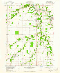
1960 Map of Oakwood
USGS Topo · Published 1961About this map
The Auglaize River snakes through the landscape of northwestern Ohio, flanked by the historical Fort Brown Boundary and the traces of the Miami and Erie Canal (Abandoned). This area of Paulding County, captured in 1960, is characterized by a series of small, rural hubs like Oakwood, Melrose, and Grover Hill. Local industry is reflected in several Claypits and a Quarry located near Roselms, indicating the geological utility of the land during this period.
Find a feature on this map
39 named features on this map. Tap any name to fly to it.
Don’t see what you’re looking for? This feature index may not catch every label — zoom into the map to look around manually.
Map Details
Editions of this 1960 Oakwood Map
2 editions found
Other maps of this area

1909 · Continental
USGS Topo · 1:62,500

1911 · Delphos
USGS Topo · 1:62,500

1914 · Van Wert
USGS Topo · 1:62,500

1914 · Paulding
USGS Topo · 1:62,500

1944 · Delphos
USGS Topo · 1:62,500

1944 · Van Wert
USGS Topo · 1:62,500

1944 · Paulding
USGS Topo · 1:62,500

1953 · Fort Wayne
USGS Topo · 1:250,000

1953 · Muncie
USGS Topo · 1:250,000

1956 · Muncie
USGS Topo · 1:250,000