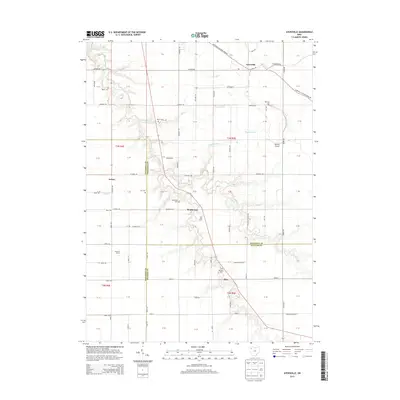
2013 Map of Ayersville
USGS Topo · Published 2013About this map
The agrarian landscape of northwest Ohio is defined here by the confluence of three counties, where the borders of Defiance, Paulding, and Putnam meet amidst a network of small drainage runs and creeks. The unincorporated settlement of Ayersville serves as a primary local hub, while smaller locales like Arthur, Southerton, and Rice punctuate the grid of country roads. For genealogists, the map is particularly useful for its documentation of family-named landmarks and rural burial grounds, including the Taylor, Myers, Hill, and Ice cemeteries.
Find a feature on this map
105 named features on this map. Tap any name to fly to it.
Don’t see what you’re looking for? This feature index may not catch every label — zoom into the map to look around manually.
Map Details
Editions of this 2013 Ayersville Map
This is the sole edition of this map. No revisions or reprints were ever made.
Other maps of this area

1907 · Defiance
USGS Topo · 1:62,500

1908 · Ottawa
USGS Topo · 1:62,500

1908 · Napoleon
USGS Topo · 1:62,500

1909 · Defiance
USGS Topo · 1:62,500

1909 · Continental
USGS Topo · 1:62,500

1953 · Fort Wayne
USGS Topo · 1:250,000

1956 · Fort Wayne
USGS Topo · 1:250,000

1959 · Defiance East
USGS Topo · 1:24,000

1959 · Florida
USGS Topo · 1:24,000
1960 · Oakwood
USGS Topo · 1:24,000