2022 Map of Ayrshire
USGS Topo · Published 2022About this map
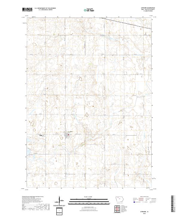
The town of Ayrshire sits at the heart of this Palo Alto County landscape, surrounded by the precise grid of section lines and rural roads that characterize this region of Iowa. The local topography is defined by the proximity of Silver Lake to the west and a sophisticated drainage network of artificial waterways like Ditch Number 176 and Ditch Number 23, which have long been essential for supporting the productive agricultural fields of the prairie. Natural watercourses such as Silver Cr and Beaver Cr wind through the countryside, often running parallel to major arteries like Silver Lake Ave or Co Hwy B53. Genealogists and local historians will find significant value in the detailed plotting of the town's immediate outskirts, where both Calvary Cem and Silver Lake Cem are clearly marked, providing a definitive record of the community's burial grounds.
Find a feature on this map
27 named features on this map. Tap any name to fly to it.
Don’t see what you’re looking for? This feature index may not catch every label — zoom into the map to look around manually.
Map Details
Editions of this 2022 Ayrshire Map
This is the sole edition of this map. No revisions or reprints were ever made.