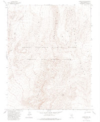
1973 Map of Aysees Peak
USGS Topo · Published 1985About this map
Aysees Peak serves as a prominent landmark within this high-desert landscape, which is largely defined by the overlap of conservation and military interests in the early 1970s. The terrain is dominated by the Spotted Range and the Buried Hills, with the northern portion of the map falling within the Desert National Wildlife Range. Simultaneously, the entire area is part of the Nellis Air Force Range, illustrating the dual-use nature of this portion of Lincoln County. Movement across this arid environment was limited to a single Jeep Trail in the western reaches, winding near Halfpoint. This 1973 survey, field-checked by the Geological Survey, preserves the specific topographic character and nomenclature of a region restricted from general public access.
Find a feature on this map
11 named features on this map. Tap any name to fly to it.
Don’t see what you’re looking for? This feature index may not catch every label — zoom into the map to look around manually.
Map Details
Editions of this 1973 Aysees Peak Map
2 editions found
Other maps of this area

1907 · Las Vegas
USGS Topo · 1:250,000

1908 · Las Vegas
USGS Topo · 1:250,000

1942 · Emigrant Valley
USGS Topo · 1:125,000

1942 · Indian Spring
USGS Topo · 1:125,000

1952 · Papoose Lake
USGS Topo · 1:62,500
1952 · Frenchman Lake
USGS Topo · 1:62,500

1954 · Caliente
USGS Topo · 1:250,000

1954 · Las Vegas
USGS Topo · 1:250,000

1957 · Las Vegas
USGS Topo · 1:250,000

1959 · Caliente
USGS Topo · 1:250,000