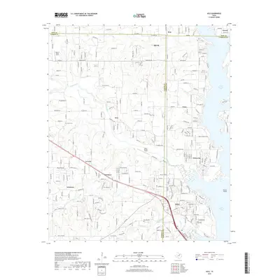
2019 Map of Azle
USGS Topo · Published 2019About this map
Azle and the surrounding shoreline of Eagle Mountain Lake define this North Texas landscape at the junction of Wise, Parker, and Tarrant Counties. The residential development of Pelican Bay and Sanctuary stands in contrast to the rural character of nearby Sabathany and La Junta. The map provides significant detail for genealogists, recording several family-named burial sites including Jaybird Cem, Nelson Cem, Reynolds Cem, and the Smith-Frazier Cem. Small aircraft infrastructure is noted with the Kezer Air Ranch Airport in the northwest and Moore Private Airport further south. The hydrography of the region is shaped by several tributaries feeding the lake, such as Ash Cr, Walnut Creek, and Briar Cr, which carve through the terrain near Burton Knob.
Find a feature on this map
241 named features on this map. Tap any name to fly to it.
Don’t see what you’re looking for? This feature index may not catch every label — zoom into the map to look around manually.
Map Details
Editions of this 2019 Azle Map
This is the sole edition of this map. No revisions or reprints were ever made.
Other maps of this area

1891 · Weatherford
USGS Topo · 1:125,000

1893 · Weatherford
USGS Topo · 1:125,000

1894 · Fort Worth
USGS Topo · 1:125,000

1924 · Sunset 4-d
USGS Topo · 1:48,000

1930 · Boyd
USGS Topo · 1:62,500

1932 · Springtown
USGS Topo · 1:62,500

1954 · Dallas
USGS Topo · 1:250,000

1954 · Sherman
USGS Topo · 1:250,000

1955 · Avondale
USGS Topo · 1:24,000

1955 · Azle
USGS Topo · 1:24,000