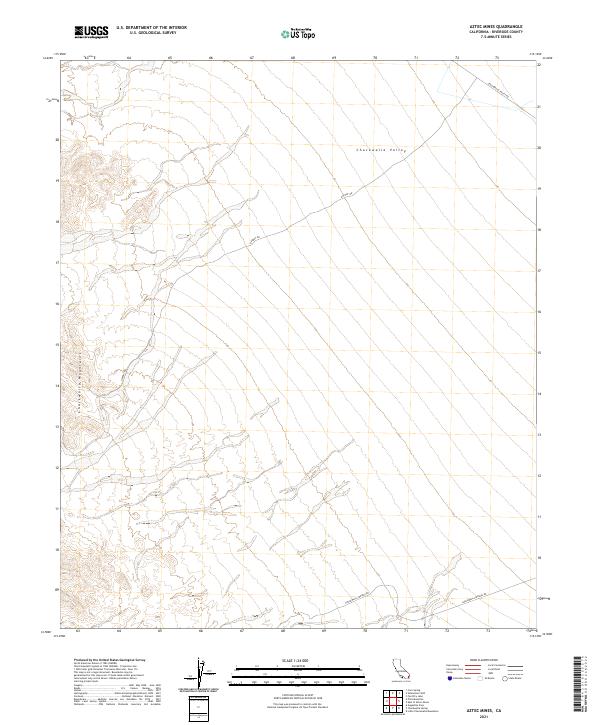
2021 Map of Aztec Mines
USGS Topo · Published 2021About this map
The Chuckwalla Mountains rise in the southwestern portion of this desert quadrangle, their ridgelines and drainages overlooking the broad Chuckwalla Valley to the north and east. This 2021 survey shows a landscape largely defined by its topography and a few persistent desert tracks. Dupont Rd cuts diagonally across the valley floor, connecting the lowlands with the higher terrain of the mountains. To the north, Chuckwalla Valley Rd runs along the boundary of the valley, while Chuckwalla Springs Rd skirts the southern reaches of the mountains near the boundary with Township 8 South. The map provides a clear look at the Public Land Survey System grid, including corners for t7s r17e and t7s r18e, essential for researchers tracking land patents and historical claims in the Riverside County desert.
Find a feature on this map
11 named features on this map. Tap any name to fly to it.
Don’t see what you’re looking for? This feature index may not catch every label — zoom into the map to look around manually.
Map Details
Editions of this 2021 Aztec Mines Map
This is the sole edition of this map. No revisions or reprints were ever made.
Other maps of this area

1940 · Iris Pass
USGS Topo · 1:62,500

1944 · Chuckwalla Mountains
USGS Topo · 1:62,500

1945 · Iris Pass
USGS Topo · 1:62,500

1952 · Sidewinder Well
USGS Topo · 1:62,500

1953 · Chuckwalla Spring
USGS Topo · 1:62,500

1954 · Salton Sea
USGS Topo · 1:250,000

1955 · Salton Sea
USGS Topo · 1:250,000

1959 · Salton Sea
USGS Topo · 1:250,000

1963 · Salton Sea
USGS Topo · 1:250,000
1963 · Iris Pass
USGS Topo · 1:62,500