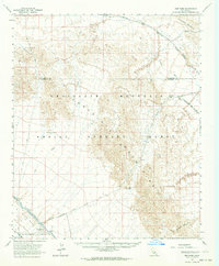
1963 Map of Iris Pass
USGS Topo · Published 1964About this map
Coachella Canal cuts through the southwestern portion of this desert landscape, where water management infrastructure like Siphon 10 and Siphon 8 supported the irrigation of the East Mesa. The topography is dominated by the massive Chocolate Mountains, a range marked by technical and historical routes including the Bradshaw Road and various jeep trails through Surveyors Pass and Augustine Pass.
Find a feature on this map
26 named features on this map. Tap any name to fly to it.
Don’t see what you’re looking for? This feature index may not catch every label — zoom into the map to look around manually.
Map Details
Editions of this 1963 Iris Pass Map
2 editions found
Other maps of this area

1940 · Iris
USGS Topo · 1:62,500

1940 · Frink
USGS Topo · 1:62,500

1940 · Iris Pass
USGS Topo · 1:62,500

1940 · Canyon Spring
USGS Topo · 1:62,500

1943 · Canyon Spring
USGS Topo · 1:62,500

1944 · Chuckwalla Mountains
USGS Topo · 1:62,500

1944 · Calipatria
USGS Topo · 1:62,500

1944 · Frink
USGS Topo · 1:62,500

1945 · Iris Pass
USGS Topo · 1:62,500

1945 · Iris
USGS Topo · 1:62,500