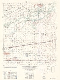
1968 Map of Aztec
USGS Topo · Published 1968About this map
Agua Caliente sits at the northern edge of this desert landscape, where the Agua Caliente Mountains rise above the Gila River valley. This 1960s era survey captures a region defined by arid-land management and transportation, featuring the Southern Pacific railroad cutting straight through Stanwix Flats near the settlement of Stanwix. The map documents the remnants of early irrigation efforts with labels for the South Gila Ditch (Abandoned) and Gila Ditch (Abandoned), alongside local water sources like Howard Well and Stamps Well. To the south, the terrain transitions into the Luke Air Force Range and the Aztec Hills, while the western reach shows Palomas and the White-Wing Ranch near a dedicated Landing Strip. These features together illustrate a mid-century desert economy reliant on rail transit and scattered ranching operations.
Find a feature on this map
36 named features on this map. Tap any name to fly to it.
Don’t see what you’re looking for? This feature index may not catch every label — zoom into the map to look around manually.
Map Details
Editions of this 1968 Aztec Map
This is the sole edition of this map. No revisions or reprints were ever made.
Other maps of this area

1927 · Aguila Mountains
USGS Topo · 1:48,000

1927 · Kim
USGS Topo · 1:62,500

1927 · Hyder
USGS Topo · 1:62,500

1929 · Aztec
USGS Topo · 1:62,500

1930 · Aguila Mountains
USGS Topo · 1:62,500

1930 · Stoval
USGS Topo · 1:62,500

1930 · Hyder
USGS Topo · 1:62,500

1931 · Kim
USGS Topo · 1:62,500

1942 · Vicksburg
USGS Topo · 1:250,000

1949 · Sentinel
USGS Topo · 1:62,500