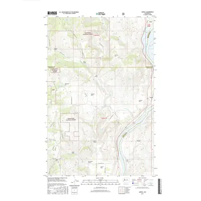
2017 Map of Azwell
USGS Topo · Published 2017About this map
Starr and Azwell occupy the eastern bank of the Columbia River in a landscape defined by dramatic elevation changes between the river valley and the high plateaus of the Okanogan National Forest. This 2017 survey reveals the intricate topography of the region, where numerous named canyons and flats, such as Wadams Canyon and Gossman Flats, break the descent toward the water. The transition from the high peaks of Arbuckle Mtn down to the orchard-friendly terrain of Howard Flats and Highland Bench illustrates the classic land-use patterns of North Central Washington.
Find a feature on this map
55 named features on this map. Tap any name to fly to it.
Don’t see what you’re looking for? This feature index may not catch every label — zoom into the map to look around manually.
Map Details
Editions of this 2017 Azwell Map
This is the sole edition of this map. No revisions or reprints were ever made.
Other maps of this area

1899 · Methow
USGS Topo · 1:125,000

1901 · Chelan
USGS Topo · 1:125,000

1901 · Methow
USGS Topo · 1:125,000

1905 · Okanogan
USGS Topo · 1:125,000

1953 · Ritzville
USGS Topo · 1:250,000

1954 · Okanogan
USGS Topo · 1:250,000

1955 · Concrete
USGS Topo · 1:250,000

1957 · Brewster
USGS Topo · 1:62,500

1957 · Wenatchee
USGS Topo · 1:250,000

1958 · Concrete
USGS Topo · 1:250,000