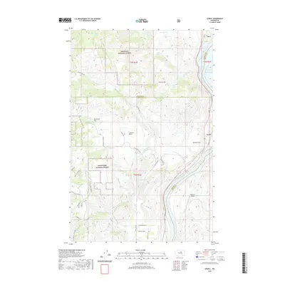
2020 Map of Azwell
USGS Topo · Published 2020About this map
The Columbia River valley north of Chelan forms the central axis of this landscape, where the settlements of Starr and Azwell occupy the narrow corridors between the water and the rising slopes of the Okanogan National Forest and Wenatchee National Forest. The map documents a complex riverside geography defined by Lake Pateros and Lake Entiat, punctuated by distinctive plateaus and benches such as Highland Bench, Gossman Flats, and Washington Flat. These flatlands historically provided the few viable locations for orchard development and habitation in a region otherwise dominated by the steep relief of Arbuckle Mtn. In the southern portion of the sheet, the Howard Flats area shows a more structured grid of rural roads like Howard Flat Rd and Apple Acres Rd, while the Riverview Airpark indicates the continued importance of regional connectivity in this portion of the Pacific Northwest.
Find a feature on this map
46 named features on this map. Tap any name to fly to it.
Don’t see what you’re looking for? This feature index may not catch every label — zoom into the map to look around manually.
Map Details
Editions of this 2020 Azwell Map
This is the sole edition of this map. No revisions or reprints were ever made.
Other maps of this area

1899 · Methow
USGS Topo · 1:125,000

1901 · Chelan
USGS Topo · 1:125,000

1901 · Methow
USGS Topo · 1:125,000

1905 · Okanogan
USGS Topo · 1:125,000

1953 · Ritzville
USGS Topo · 1:250,000

1954 · Okanogan
USGS Topo · 1:250,000

1955 · Concrete
USGS Topo · 1:250,000

1957 · Brewster
USGS Topo · 1:62,500

1957 · Wenatchee
USGS Topo · 1:250,000

1958 · Concrete
USGS Topo · 1:250,000