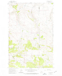
1962 Map of B K Ranch
USGS Topo · Published 1977About this map
The B K Ranch sits at the northern edge of this high-elevation Montana landscape, where the waters of Hound Creek and Middle Creek begin their descent through the foothills. The terrain is defined by the sharp transition from ranch lands into the timbered slopes of the Helena National Forest, a boundary that aligns with the rugged spine of Elk Ridge. This area, mapped in the early 1960s, reveals a network of watercourses including Elk Creek, Crooked Creek, and Whitetail Creek that carve deep drainage patterns through the mountain front.
Find a feature on this map
16 named features on this map. Tap any name to fly to it.
Don’t see what you’re looking for? This feature index may not catch every label — zoom into the map to look around manually.
Map Details
Editions of this 1962 B K Ranch Map
2 editions found

Other maps of this area

1886 · Great Falls
USGS Topo · 1:250,000

1886 · Fort Logan
USGS Topo · 1:250,000

1948 · White Sulphur Springs
USGS Topo · 1:250,000

1954 · Great Falls
USGS Topo · 1:250,000

1957 · Great Falls
USGS Topo · 1:250,000

1958 · White Sulphur Springs
USGS Topo · 1:250,000

1961 · White Sulphur Springs
USGS Topo · 1:250,000

1961 · Hound Creek Reservoir
USGS Topo · 1:24,000

1961 · Dana Ranch
USGS Topo · 1:24,000

1962 · Hogback Mountain
USGS Topo · 1:24,000