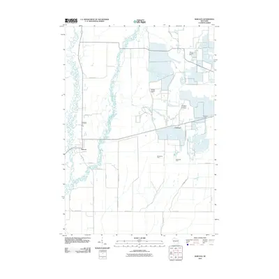
2010 Map of Babcock
USGS Topo · Published 2010About this map
The Yellow River and its intricate wetlands dominate this 2010 survey of central Wisconsin, where the landscape is defined by its water management and agricultural specialized aviation. The settlement of Babcock sits near the river's winding path, while further east, Cranmoor is surrounded by the distinctive rectangular patterns of cranberry bogs. These marshy lowlands are served by a network of small airfields and landing strips, including Whittlesey Cranberry Co Airport, Bennett Landing Strip, and Brazeau Landing Strip, highlighting the intersection of local aviation and the region's agricultural economy.
Find a feature on this map
28 named features on this map. Tap any name to fly to it.
Don’t see what you’re looking for? This feature index may not catch every label — zoom into the map to look around manually.
Map Details
Editions of this 2010 Babcock Map
This is the sole edition of this map. No revisions or reprints were ever made.
Other maps of this area

1953 · Eau Claire
USGS Topo · 1:250,000

1955 · Green Bay
USGS Topo · 1:250,000

1957 · Wisconsin Rapids
USGS Topo · 1:48,000

1957 · Pittsville
USGS Topo · 1:48,000

1958 · Eau Claire
USGS Topo · 1:250,000

1958 · Arkdale
USGS Topo · 1:48,000

1958 · Necedah
USGS Topo · 1:48,000

1964 · Eau Claire
USGS Topo · 1:250,000

1967 · Wisconsin Rapids
USGS Topo · 1:62,500

1967 · Pittsville
USGS Topo · 1:62,500