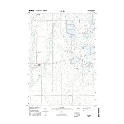
2015 Map of Babcock
USGS Topo · Published 2015About this map
Yellow River and Hemlock Creek define the hydrologic character of this central Wisconsin landscape, where the geography is heavily shaped by the region's cranberry production industry. The unincorporated community of Cranmoor sits amidst a network of drainage canals and specialized agriculture, supported by the Whittlesey Cranberry Co Airport and specialized fields like Gottschalk Field. To the west, the settlement of Babcock serves as a local hub near the Babcock Cem, while Dexterville occupies the northern reach of the survey. The transport network reflects a transition from early wilderness trails to a grid of rural lanes with evocative names such as Lonesome Rd and Hemlock Trl. This documentation captures the precise intersections of water management and rural life, including the course of Cranberry Cr as it flows through the township boundaries of t22n r4e and t21n r4e.
Find a feature on this map
31 named features on this map. Tap any name to fly to it.
Don’t see what you’re looking for? This feature index may not catch every label — zoom into the map to look around manually.
Map Details
Editions of this 2015 Babcock Map
This is the sole edition of this map. No revisions or reprints were ever made.
Other maps of this area

1953 · Eau Claire
USGS Topo · 1:250,000

1955 · Green Bay
USGS Topo · 1:250,000

1957 · Wisconsin Rapids
USGS Topo · 1:48,000

1957 · Pittsville
USGS Topo · 1:48,000

1958 · Eau Claire
USGS Topo · 1:250,000

1958 · Arkdale
USGS Topo · 1:48,000

1958 · Necedah
USGS Topo · 1:48,000

1964 · Eau Claire
USGS Topo · 1:250,000

1967 · Wisconsin Rapids
USGS Topo · 1:62,500

1967 · Pittsville
USGS Topo · 1:62,500