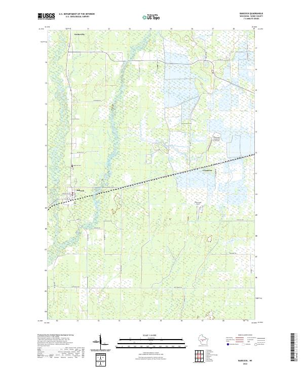
2022 Map of Babcock
USGS Topo · Published 2022About this map
Babcock and Cranmoor anchor this Wood County landscape, where the geography is defined by a extensive network of drainage and agricultural irrigation systems. The map reveals the specialized infrastructure of the region's cranberry industry, most notably at the Whittlesey Cranberry Co Airport and the surrounding marshy impoundments. This water-managed terrain is fed by Hemlock Creek and Cranberry Creek, which move through a grid of rural roads and section lines. To the north, the settlement of Dexterville sits near the upper reaches of these drainage basins. Genealogists will find the Babcock Cem located just north of the main village, while local aviators and historians may note smaller landmarks like Gottschalk Field. The road network, including Marathon Ave and Necedah Rd, provides a clear view of how these small communities are interconnected across the wetland-rich interior of Central Wisconsin.
Find a feature on this map
34 named features on this map. Tap any name to fly to it.
Don’t see what you’re looking for? This feature index may not catch every label — zoom into the map to look around manually.
Map Details
Editions of this 2022 Babcock Map
This is the sole edition of this map. No revisions or reprints were ever made.
Other maps of this area

1953 · Eau Claire
USGS Topo · 1:250,000

1955 · Green Bay
USGS Topo · 1:250,000

1957 · Wisconsin Rapids
USGS Topo · 1:48,000

1957 · Pittsville
USGS Topo · 1:48,000

1958 · Eau Claire
USGS Topo · 1:250,000

1958 · Arkdale
USGS Topo · 1:48,000

1958 · Necedah
USGS Topo · 1:48,000

1964 · Eau Claire
USGS Topo · 1:250,000

1967 · Wisconsin Rapids
USGS Topo · 1:62,500

1967 · Pittsville
USGS Topo · 1:62,500