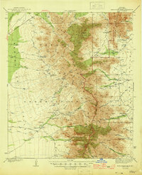
1944 Map of Baboquivari Peak
USGS Topo · Published 1944About this map
The Baboquivari Mountains and Quinlan Mountains dominate this 1941 survey, which captures the high-desert landscape of the Papago Indian Reservation during the early war years. The area is defined by a series of isolated settlements and camps, including Gu Chuapo, Kohi Kug, and Chiuli Shaik, many connected by the Foothill Truck Trail and the Ajo Tucson Highway. Notable landmarks such as Baboquivari Peak and Kitt Peak tower over the Alambre Valley, while evidence of historical habitation is seen at Indian Ruins and the Fresnal Canyon Sch. The eastern slopes show a ranching and mining presence, featuring Redondo Ranch, Otero Ranch, and the Allison Mine near Allison Camp. This map provides a detailed view of the water sources critical to these desert communities, from San Juan Spring to the numerous washes like Baboquivari Wash and Contreras Wash.
Find a feature on this map
64 named features on this map. Tap any name to fly to it.
Don’t see what you’re looking for? This feature index may not catch every label — zoom into the map to look around manually.
Map Details
Editions of this 1944 Baboquivari Peak Map
2 editions found

Other maps of this area

1920 · Arivaca
USGS Topo · 1:125,000

1934 · Tucson Mountains
USGS Topo · 1:125,000

1934 · Silver Bell
USGS Topo · 1:125,000

1937 · Comobabi
USGS Topo · 1:48,000

1938 · San Vicente
USGS Topo · 1:62,500

1940 · Palo Alto Ranch
USGS Topo · 1:62,500

1941 · Presumido Peak
USGS Topo · 1:62,500

1941 · San Vicente
USGS Topo · 1:62,500

1941 · Cocoraque Butte
USGS Topo · 1:62,500

1941 · Baboquivari Peak
USGS Topo · 1:62,500