
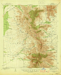
1944 Map of Baboquivari Peak
USGS Topo · Published 1944About this map
The Papago Indian Reservation encompasses much of this desert landscape, where the Baboquivari Mountains and Quinlan Mountains rise sharply above the basin floor. The map documents a sparsely populated region defined by ranching and small tribal settlements like Sells, Topawa, and Ali Molina. High-altitude landmarks such as Kitt Peak and the prominent Baboquivari Peak dominate the skyline, while the land below is etched with an intricate network of desert washes, including Comobabi Wash and Alambre Wash.
Find a feature on this map
58 named features on this map. Tap any name to fly to it.
Don’t see what you’re looking for? This feature index may not catch every label — zoom into the map to look around manually.
Map Details
Editions of this 1944 Baboquivari Peak Map
2 editions found
Other maps of this area

1920 · Arivaca
USGS Topo · 1:125,000

1934 · Tucson Mountains
USGS Topo · 1:125,000

1934 · Silver Bell
USGS Topo · 1:125,000

1937 · Comobabi
USGS Topo · 1:48,000

1938 · San Vicente
USGS Topo · 1:62,500

1940 · Palo Alto Ranch
USGS Topo · 1:62,500

1941 · Presumido Peak
USGS Topo · 1:62,500

1941 · San Vicente
USGS Topo · 1:62,500

1941 · Cocoraque Butte
USGS Topo · 1:62,500

1941 · Baboquivari Peak
USGS Topo · 1:62,500