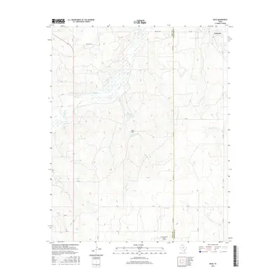
2016 Map of Back
USGS Topo · Published 2016About this map
The Gray Co Wheeler Co line bisects this Panhandle landscape, where the settlement of Kellerville sits at the junction of FM 2473 and FM 1443. The terrain is defined by a dendritic network of seasonal drainages, including the prominent McClellan Cr and the various branches of Hackberry Cr. Water is a scarce but vital feature in this region, evidenced by the presence of Hackberry Spring and R D Back Lake, as well as the deep Saye Draw. The southern portion of the sheet is anchored by the Mc Lean/Gray County Airport, serving as a modern landmark amidst a grid of rural routes such as Gray 28, X Rd, and Gray Y. These local roads follow the section lines characteristic of the Texas High Plains, providing access to the vast ranching and oil-producing lands that define the county's economy.
Find a feature on this map
29 named features on this map. Tap any name to fly to it.
Don’t see what you’re looking for? This feature index may not catch every label — zoom into the map to look around manually.
Map Details
Editions of this 2016 Back Map
This is the sole edition of this map. No revisions or reprints were ever made.
Other maps of this area

1954 · Amarillo
USGS Topo · 1:250,000

1958 · Amarillo
USGS Topo · 1:250,000

1962 · Hudgens Ranch
USGS Topo · 1:24,000

1962 · Back
USGS Topo · 1:24,000

1962 · Pond Creek
USGS Topo · 1:24,000

1962 · Spring Creek
USGS Topo · 1:24,000

1962 · Pakan
USGS Topo · 1:24,000

1962 · Pond Creek NW
USGS Topo · 1:24,000

1963 · Alanreed
USGS Topo · 1:24,000

1963 · Ramsdell
USGS Topo · 1:24,000