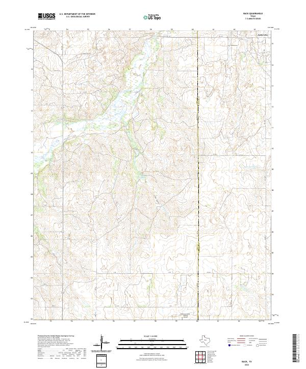
2022 Map of Back
USGS Topo · Published 2022About this map
McLean/Gray County Airport sits on the southern edge of this West Texas landscape, where the high plains begin to break into the drainage systems of the eastern Panhandle. The small community of Kellerville is situated in the northeast corner, serving as a focal point for a network of rural roads such as Ranch Rd 2473 and FM 2473. The terrain is defined by its intermittent watercourses, including the winding McClellan Creek and the intricate draws of Hackberry Creek. The prominence of Hackberry Spring and seasonal features like Dry Sandy Creek and Saye Draw illustrates the critical role of water management and natural drainage in this ranching country. The map also delineates the jurisdictional boundary between Gray County and Wheeler County, cutting vertically through the eastern half of the survey area.
Find a feature on this map
23 named features on this map. Tap any name to fly to it.
Don’t see what you’re looking for? This feature index may not catch every label — zoom into the map to look around manually.
Map Details
Editions of this 2022 Back Map
This is the sole edition of this map. No revisions or reprints were ever made.
Other maps of this area

1954 · Amarillo
USGS Topo · 1:250,000

1958 · Amarillo
USGS Topo · 1:250,000

1962 · Hudgens Ranch
USGS Topo · 1:24,000

1962 · Back
USGS Topo · 1:24,000

1962 · Pond Creek
USGS Topo · 1:24,000

1962 · Spring Creek
USGS Topo · 1:24,000

1962 · Pakan
USGS Topo · 1:24,000

1962 · Pond Creek NW
USGS Topo · 1:24,000

1963 · Alanreed
USGS Topo · 1:24,000

1963 · Ramsdell
USGS Topo · 1:24,000