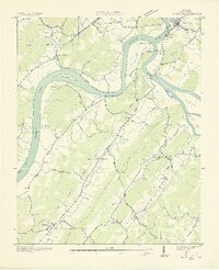
1936 Map of Bacon Gap
USGS Topo · Published 1936About this map
Kingston sits at the strategic confluence of the Tennessee River and the Clinch River, a landscape defined by waterway transit in the mid-1930s. The region is characterized by numerous river crossings, including the Twin Rivers Ferry and the Hood Landing Ferry, which connected the rural ridge communities of Bacon Ridge and Welcer Ridge. The mapping captures a network of family and community landmarks, from the Bethel Cem near the riverbanks to inland gathering places like Ponder Ch and Chamberlin Sch. Local industry and infrastructure are represented by the Southern Railway corridor and emerging utility lines from the Tennessee Valley Authority. This survey, compiled from aerial photographs, preserves the locations of early settlements like Barnardsville and Riley before further industrial and hydrological changes altered the Roane County riverfront.
Find a feature on this map
54 named features on this map. Tap any name to fly to it.
Don’t see what you’re looking for? This feature index may not catch every label — zoom into the map to look around manually.
Map Details
Editions of this 1936 Bacon Gap Map
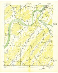
2 editions found
Other maps of this area

1887 · Kingston
USGS Topo · 1:125,000

1891 · Kingston
USGS Topo · 1:125,000

1893 · Kingston
USGS Topo · 1:125,000

1895 · Loudon
USGS Topo · 1:125,000

1935 · Rockwood
USGS Topo · 1:24,000

1935 · Elverton
USGS Topo · 1:24,000

1935 · Harriman
USGS Topo · 1:24,000

1935 · Philadelphia
USGS Topo · 1:24,000

1936 · Cave Creek
USGS Topo · 1:24,000

1936 · Cardiff
USGS Topo · 1:24,000