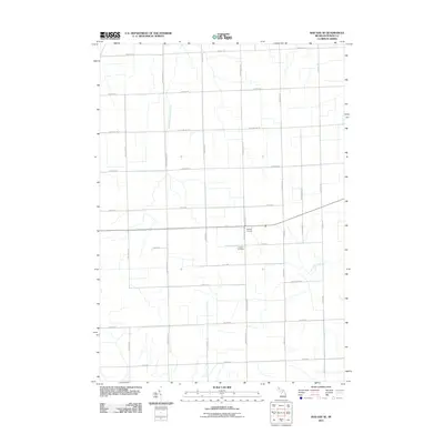
2011 Map of Bad Axe SE
USGS Topo · Published 2011About this map
Halfway Corners serves as a central junction in this rural section of Huron County, where agricultural land is neatly partitioned by a rigid grid of local thoroughfares. This landscape is defined by its drainage and connectivity, with the East Branch Willow Creek winding through the northern reaches while Rock Falls Creek cuts across the southeast. The survey highlights a deeply established township structure, where family and local history are anchored at sites like the Lutheran Cemetery. The road network itself carries the names of many early residents, such as Mckichen Rd, Puvalowski Rd, and Maurer Rd, reflecting the generational footprint of the families who settled this part of the Michigan Thumb.
Find a feature on this map
32 named features on this map. Tap any name to fly to it.
Don’t see what you’re looking for? This feature index may not catch every label — zoom into the map to look around manually.
Map Details
Editions of this 2011 Bad Axe SE Map
This is the sole edition of this map. No revisions or reprints were ever made.
Other maps of this area

1954 · Flint
USGS Topo · 1:250,000

1958 · Flint
USGS Topo · 1:250,000

1963 · Ruth
USGS Topo · 1:24,000

1963 · Ubly
USGS Topo · 1:24,000

1963 · Minden City
USGS Topo · 1:24,000

1970 · Port Hope
USGS Topo · 1:24,000

1970 · Kinde East
USGS Topo · 1:24,000

1970 · Redman
USGS Topo · 1:24,000

1970 · Harbor Beach
USGS Topo · 1:24,000

1970 · Bad Axe SE
USGS Topo · 1:24,000