
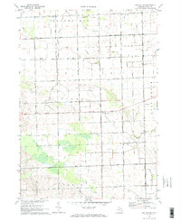
1970 Map of Bad Axe SE
USGS Topo · Published 1973About this map
Agricultural lands in Huron County are defined by an extensive drainage network in this 1970 snapshot of the Thumb region. Bordered by the townships of Bloomfield, Sigel, Paris, and Sherman, the landscape is partitioned into a strict grid of section line roads and family-named routes like Kipper Road and Duda Road. Small social hubs such as Halfway Corners and several country schools, including Jericho Sch, Adams Sch, and Eccles Sch, serve as the primary landmarks for rural life. The hydrology of the area is heavily modified for farming, evidenced by named canals like the Parisville Drain and Sigel Drain which feed into natural watercourses like Willow Creek and Rock Falls Creek. This map captures a moment in Michigan's interior where the legacy of early 20th-century rural education and organized land drainage remained central to the community's geographic identity.
Find a feature on this map
38 named features on this map. Tap any name to fly to it.
Don’t see what you’re looking for? This feature index may not catch every label — zoom into the map to look around manually.
Map Details
Editions of this 1970 Bad Axe SE Map
2 editions found
Other maps of this area

1954 · Flint
USGS Topo · 1:250,000

1958 · Flint
USGS Topo · 1:250,000

1963 · Ruth
USGS Topo · 1:24,000

1963 · Ubly
USGS Topo · 1:24,000

1963 · Minden City
USGS Topo · 1:24,000

1970 · Port Hope
USGS Topo · 1:24,000

1970 · Kinde East
USGS Topo · 1:24,000

1970 · Redman
USGS Topo · 1:24,000

1970 · Harbor Beach
USGS Topo · 1:24,000
1970 · Bad Axe East
USGS Topo · 1:24,000
Featured Places
- Bloomfield Township, MI
- Sigel Township, MI
- Rubicon Township, MI
- Sand Beach Township, MI
- Sherman Township, MI