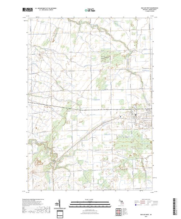
2023 Map of Bad Axe West
USGS Topo · Published 2023About this map
The Pinnebog River and its intricate network of agricultural drains shape the landscape west of Bad Axe. This modern 2023 survey illustrates the highly organized section-line road system characteristic of the Michigan Thumb, where water management is central to the land's utility. Notable watercourses such as the McMullen Drain and Southworth Drain feed into the river, while the small settlement of Popple sits near the intersection of several local drainage systems.
Find a feature on this map
70 named features on this map. Tap any name to fly to it.
Don’t see what you’re looking for? This feature index may not catch every label — zoom into the map to look around manually.
Map Details
Editions of this 2023 Bad Axe West Map
This is the sole edition of this map. No revisions or reprints were ever made.
Other maps of this area

1954 · Flint
USGS Topo · 1:250,000

1958 · Flint
USGS Topo · 1:250,000

1963 · New Greenleaf
USGS Topo · 1:24,000

1963 · Ubly
USGS Topo · 1:24,000

1963 · Gagetown
USGS Topo · 1:24,000
1970 · Rush Lake
USGS Topo · 1:24,000

1970 · Kinde East
USGS Topo · 1:24,000

1970 · Kinde West
USGS Topo · 1:24,000

1970 · Bad Axe West
USGS Topo · 1:24,000
1970 · Elkton
USGS Topo · 1:24,000