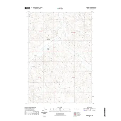
2020 Map of Badbaby Coulee
USGS Topo · Published 2020About this map
Pryor Cr winds through this section of Yellowstone County, providing a vital water source in a landscape defined by its network of named coulees. The topographic character of the region is punctuated by prominent drainage features such as Badbaby Coulee, Cashen Coulee, and Sue Jane Coulee, which illustrate the natural erosion patterns across the range. Infrastructure in this area is primarily focused on agricultural and service needs, evidenced by the presence of Coburn Ditch and a network of rural routes. Notable thoroughfares include Hardin Rd and the Vermandel-Indian Svc Rd, reflecting the intersection of local ranching access and service requirements on this varied terrain. These features highlight a territory where water management and topography have historically dictated the placement of roads and homestead access.
Find a feature on this map
19 named features on this map. Tap any name to fly to it.
Don’t see what you’re looking for? This feature index may not catch every label — zoom into the map to look around manually.
Map Details
Editions of this 2020 Badbaby Coulee Map
This is the sole edition of this map. No revisions or reprints were ever made.
Other maps of this area

1893 · Huntley
USGS Topo · 1:125,000

1954 · Billings
USGS Topo · 1:250,000

1956 · Billings East
USGS Topo · 1:24,000

1957 · Billings
USGS Topo · 1:250,000

1958 · Billings
USGS Topo · 1:250,000

1967 · Soda Springs NW
USGS Topo · 1:24,000

1967 · Soda Springs
USGS Topo · 1:24,000

1967 · Cottonwood Creek
USGS Topo · 1:24,000
1967 · Badbaby Coulee
USGS Topo · 1:24,000
1967 · Vale Creek Ranch
USGS Topo · 1:24,000