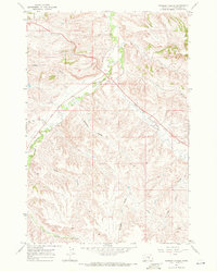
1967 Map of Badbaby Coulee
USGS Topo · Published 1972About this map
The Crow Indian Res boundary marks the northern edge of this Montana landscape, where the drainage systems of Yellowstone County transition into deep, named ravines. Centered on the distinctive Badbaby Coulee, the terrain is defined by a network of seasonal watercourses and topographic depressions including Casben Coulee, Smitty Coulee, and Sue Jane Coulee. These features flow toward larger drainages such as Pryor Creek and Alkali Creek, illustrating the complex natural irrigation of the region.
Find a feature on this map
14 named features on this map. Tap any name to fly to it.
Don’t see what you’re looking for? This feature index may not catch every label — zoom into the map to look around manually.
Map Details
Editions of this 1967 Badbaby Coulee Map
2 editions found
Other maps of this area

1893 · Huntley
USGS Topo · 1:125,000

1954 · Billings
USGS Topo · 1:250,000

1956 · Billings East
USGS Topo · 1:24,000

1957 · Billings
USGS Topo · 1:250,000

1958 · Billings
USGS Topo · 1:250,000

1967 · Soda Springs NW
USGS Topo · 1:24,000

1967 · Soda Springs
USGS Topo · 1:24,000

1967 · Cottonwood Creek
USGS Topo · 1:24,000
1967 · Vale Creek Ranch
USGS Topo · 1:24,000
1969 · Woody Mountain NW
USGS Topo · 1:24,000