
1967 Map of Soda Springs NW
USGS Topo · Published 1971About this map
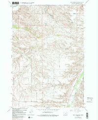
The Crow Indian Reservation Boundary bisects this landscape south of Yellowstone, defining a rugged territory of coulees and creek drainages in the late 1960s. The northern reaches feature the Billings Racetrack and the cultural footprint of Indian Cave State Park, where the high plains break into steep topographic relief. Water distribution is the primary driver of the rural layout here, with Blue Creek, Bitter Creek, and Pryor Creek carving deep paths through the terrain. Evidence of rural infrastructure is sparse but significant, including the Morin Sch and the distinct path of the Pipeline cutting across the eastern sections. The map reveals the intricate network of family-named water features like Sue Jane Coulee and Cashen Coulee, which speak to the local history of ranching and land use along the reservation's edge.
Find a feature on this map
18 named features on this map. Tap any name to fly to it.
Don’t see what you’re looking for? This feature index may not catch every label — zoom into the map to look around manually.
Map Details
Editions of this 1967 Soda Springs NW Map
3 editions found
Other maps of this area

1893 · Huntley
USGS Topo · 1:125,000

1954 · Billings
USGS Topo · 1:250,000

1956 · Yegen
USGS Topo · 1:24,000

1956 · Billings East
USGS Topo · 1:24,000

1957 · Billings
USGS Topo · 1:250,000

1957 · Billings West
USGS Topo · 1:24,000

1958 · Billings
USGS Topo · 1:250,000

1967 · Soda Springs
USGS Topo · 1:24,000

1967 · Cottonwood Creek
USGS Topo · 1:24,000
1967 · Badbaby Coulee
USGS Topo · 1:24,000