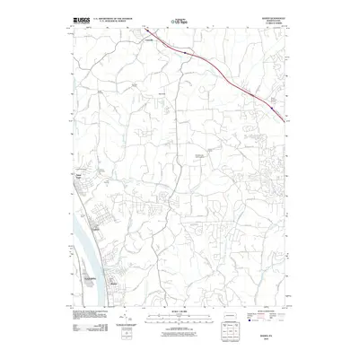
2010 Map of Baden
USGS Topo · Published 2010About this map
The Ohio River corridor defines this industrial and residential landscape, anchored by the riverfront communities of Baden, Conway, and Aliquippa. The infrastructure of the river-and-rail economy is evident at the expansive Conway Yard, while local civic life is documented through the locations of the Baden Post Office and Conway Post Office. Further inland, the terrain rises toward the prominent Big Knob, a landmark that overlooks a more rural patchwork of small settlements like Unionville and agricultural centers like the Big Knob Grange.
Find a feature on this map
93 named features on this map. Tap any name to fly to it.
Don’t see what you’re looking for? This feature index may not catch every label — zoom into the map to look around manually.
Map Details
Editions of this 2010 Baden Map
This is the sole edition of this map. No revisions or reprints were ever made.
Other maps of this area

1901 · Beaver
USGS Topo · 1:62,500

1902 · New Castle
USGS Topo · 1:62,500

1904 · Newcastle
USGS Topo · 1:62,500

1904 · Beaver
USGS Topo · 1:62,500

1906 · Sewickley
USGS Topo · 1:62,500

1908 · Sewickley
USGS Topo · 1:62,500

1908 · Zelienople
USGS Topo · 1:62,500

1910 · Zelienople
USGS Topo · 1:62,500

1951 · Canton
USGS Topo · 1:250,000

1953 · Canton
USGS Topo · 1:250,000