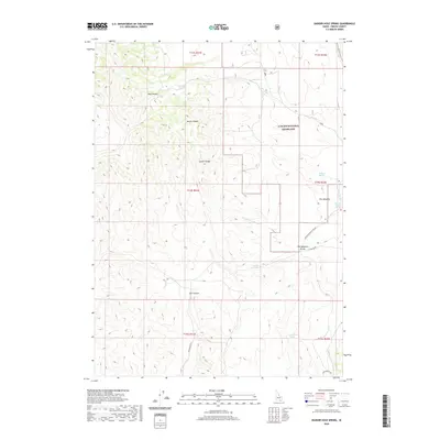
2020 Map of Badger Hole Spring
USGS Topo · Published 2020About this map
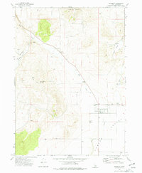
Curlew National Grassland dominates the northeastern portion of this topographic survey, marking a protected expanse of the eastern Great Basin. The landscape is defined by the high elevations of the Sublett Range, where deep drainages like Hay Canyon and North Canyon carve into the terrain. This area is critically tied to its water sources, with numerous named points of interest revolving around isolated water features such as Quaking Asp Spring, Salyer Spring, and Badger Hole Spring. These locations often served as vital landmarks for grazing and travel in a semi-arid region. In the east, The Meadows and The Meadows Divide suggest a shift toward slightly more hospitable ground near Meadow Brook Cr. Remote transit is facilitated by a sparse network of roads, including Holbrook Black Pine Rd and Cow Canyon Rd.
Find a feature on this map
24 named features on this map. Tap any name to fly to it.
Don’t see what you’re looking for? This feature index may not catch every label — zoom into the map to look around manually.
Map Details
Editions of this 2020 Badger Hole Spring Map
This is the sole edition of this map. No revisions or reprints were ever made.
Other maps of this area

1954 · Pocatello
USGS Topo · 1:250,000

1958 · Pocatello
USGS Topo · 1:250,000

1973 · Juniper
USGS Topo · 1:24,000

1973 · The Cove
USGS Topo · 1:24,000

1973 · Sublett Troughs
USGS Topo · 1:24,000
1973 · Roy
USGS Topo · 1:24,000

1973 · Black Pine
USGS Topo · 1:24,000
1973 · Stone
USGS Topo · 1:24,000
1973 · Badger Hole Spring
USGS Topo · 1:24,000
1973 · Holbrook
USGS Topo · 1:24,000