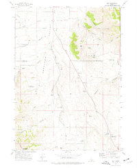
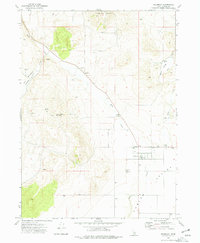
1973 Map of Roy
USGS Topo · Published 1977About this map
Rockland Valley provides the central topographic structure for this Idaho landscape, where the small settlement of Roy sits near the confluence of several high-desert drainages. The 1970s terrain is defined by its water sources, with numerous family-named and geographic springs like Sagehen Springs, Lonergan Springs, and Peterson Spring supporting the local ranching economy. The Kress Hansen Road traverses the valley floor, connecting remote homesteads such as the Hansen Ranch.
Find a feature on this map
38 named features on this map. Tap any name to fly to it.
Don’t see what you’re looking for? This feature index may not catch every label — zoom into the map to look around manually.
Map Details
Editions of this 1973 Roy Map
This is the sole edition of this map. No revisions or reprints were ever made.
Other maps of this area

1954 · Pocatello
USGS Topo · 1:250,000

1958 · Pocatello
USGS Topo · 1:250,000

1973 · Juniper
USGS Topo · 1:24,000

1973 · Hartley Peak
USGS Topo · 1:24,000

1973 · Sublett Troughs
USGS Topo · 1:24,000
1973 · Badger Hole Spring
USGS Topo · 1:24,000
1973 · Deep Creek Peak
USGS Topo · 1:24,000
1973 · Roy NE
USGS Topo · 1:24,000
1973 · Holbrook
USGS Topo · 1:24,000
1973 · Cedarhill
USGS Topo · 1:24,000